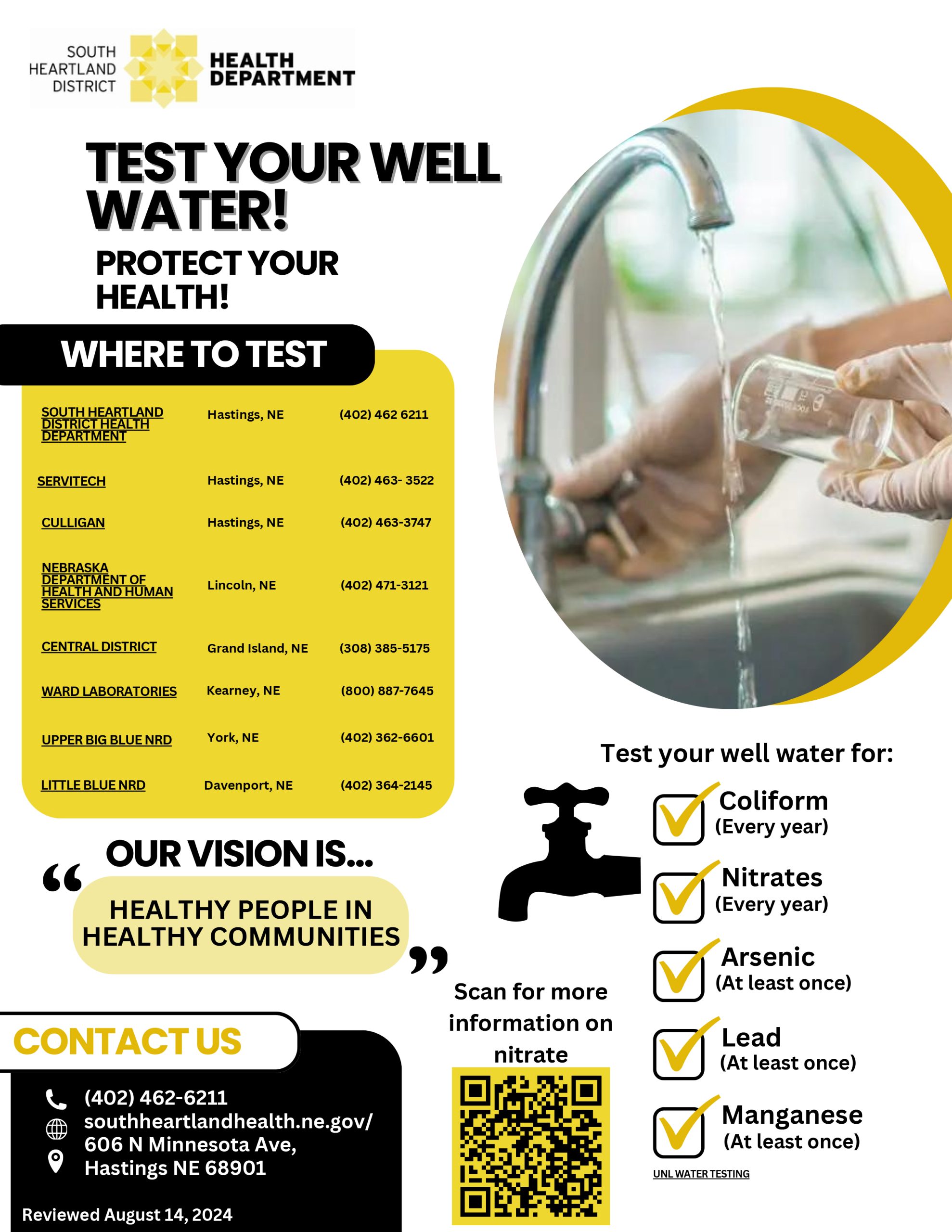
Groundwater Management
CSD Interactive Water Levels Map
On the left side of the screen, check active water levels. Copy and paste 402504097432201 into the search bar and hit enter. The popup will show the last 5 years of measurements for the Shickley recorder. If you click “View Hydrograph and Additional Water Levels” in the popup, it will show you all the data there is for the well. All data we collect from this well in the future will appear on this site. Click on any of the blue squares to see the water levels for that well and its 5 year history.
2025 Spring Water Levels Prompt Mandatory Groundwater Allocations in Little Blue NRD
Spring groundwater levels have decreased 4’9” in the last four years in Geologic Area 1, and more than 3’4” in Geologic Area 2. These drops in the water table have initiated allocations and a stay in those areas, respectively. Spring groundwater levels in Geologic Area 1 have fallen below the trigger threshold for the second consecutive year prompting a mandatory allocation for Geologic Area 1 of 65 inches per acre over a 5-year period, beginning with the current crop year, extending through the 2029 growing season.
Mandatory groundwater allocations apply to all high-capacity irrigation, municipal, industrial, recreational, and fish & wildlife users. Livestock wells are exempt from allocations. If at the end of the allocation period the operator has a remaining balance, up to eight inches may be carried over to the next allocation period. If an operator exceeds their 5-year allotted acre inch allocation, the subsequent allocation period will be reduced by two times the amount of overage. Spring groundwater levels in Geologic Area 2 have fallen below the trigger threshold for the first time, setting off a stay in Geologic Area 2. Most of Geologic Area 2 had been under a stay since March 2006, but the stay now extends throughout the entirety of Geologic Area 2. The stay redistricts the construction of all high-capacity wells and expansion of irrigated acres. The stay will remain in effect indefinitely unless specific action of the Board dictates otherwise. The construction of replacement wells will continue to be permitted, though inactive wells may not be brought back into service. Irrigation projects for which the owner/operator have substantially completed may be allowed to be completed by the NRD. Notification and documentation of substantial completion are required as proof of such completion.
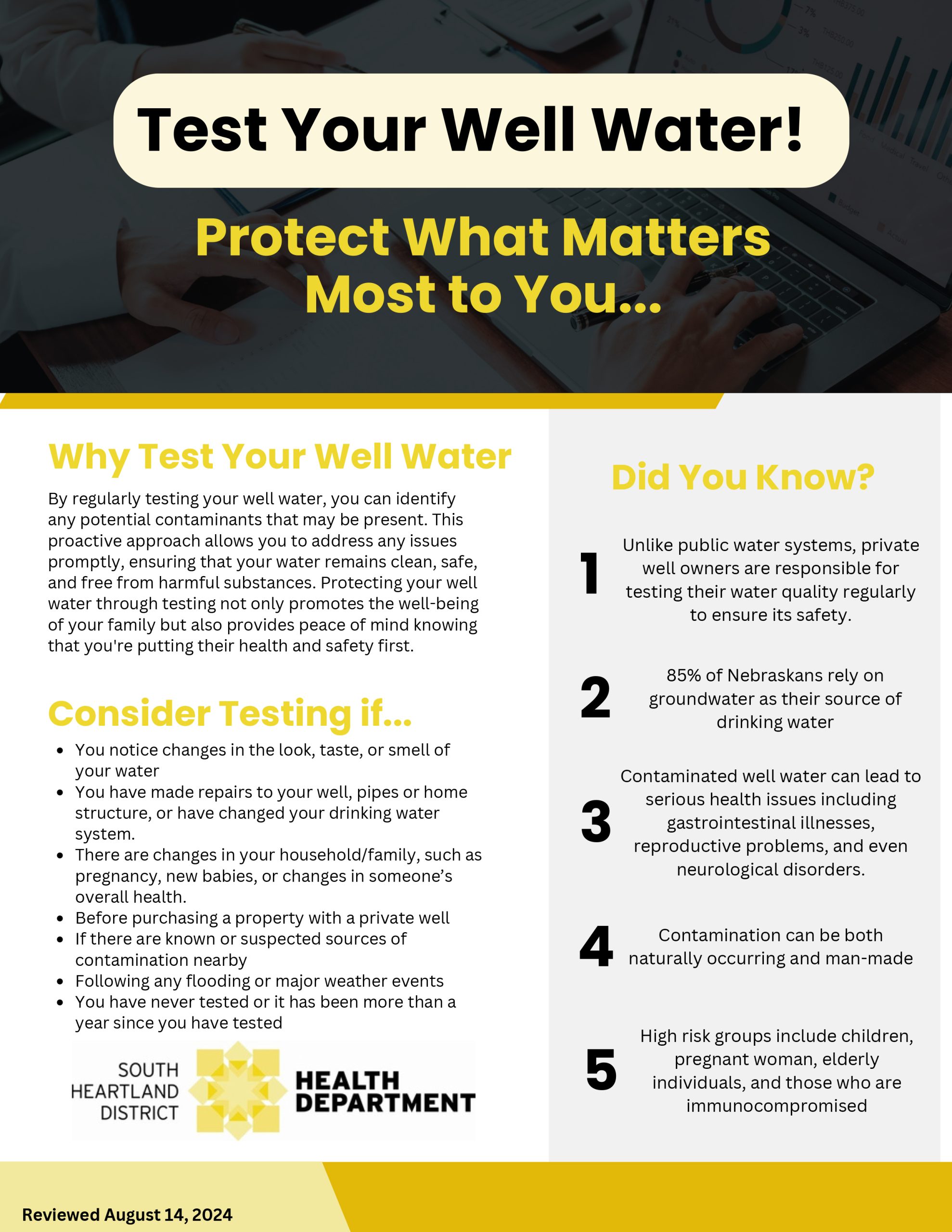
Water Quality
Learn more about what our district is facing when it comes to nitrate levels, and what to do if you are in a sub area. Also, to view other information such as our irrigation scheduling tips and operator training dates please click Learn More.
Water Quantity
For more information on our meter maintenance program. Also, to view other information like static water level history, and approved flow meters please click Learn More.
Well Information
Chemigation
Rules & Regulations
The District has developed a comprehensive Water Management Plan. This plan is an ongoing effort to protect this important resource we rely on for our daily lives.
The Little Blue NRD Board of Directors approved revisions to regulations for administering the Groundwater Management and Protection Act that were effective as of May 12, 2011.
Current Stays on Well Drilling